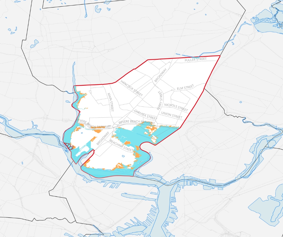
FEMA has released new flood maps, and more properties in Everett are now affected. These changes took effect July 8, 2025. Check your address, then contact your insurance provider and mortgage company to understand how your coverage or rates may change.
What’s new:
-
FEMA has released updated Flood Insurance Rate Maps (FIRMs) for Everett.
-
These maps show where flood risk has changed based on new data, mapping technology, and environmental conditions.
Why it matters:
-
💧 Mandatory flood insurance may now apply to properties in newly designated high-risk areas.
-
💸 Insurance rates may change.
-
🧱 New permit requirements apply for certain building or repair projects in flood zones.
What to do:
-
Contact your lender or insurance provider if you’re in a new high-risk zone.
-
Check in with the City to review our updated floodplain regulations before starting any construction or repairs.
Zoom in:
-
The new maps are based on improved risk assessments and digital mapping techniques.
-
Changes help ensure insurance requirements, building codes, and safety plans reflect current flood risks.